
Haunted Yubari School
Posted on
For those who enjoy haunted stories, like dark and eerie places, and are ghost chasers, Yubari is definitely a place you need to stop and check out. Yubari was once a thriving town and due to the coal mine closing down and the town going bankrupt, it has seen a massive population decline. The abandoned infrastructure and silent streets create a stark, haunting environment, with some specific locations linked to paranormal stories. Read More ....


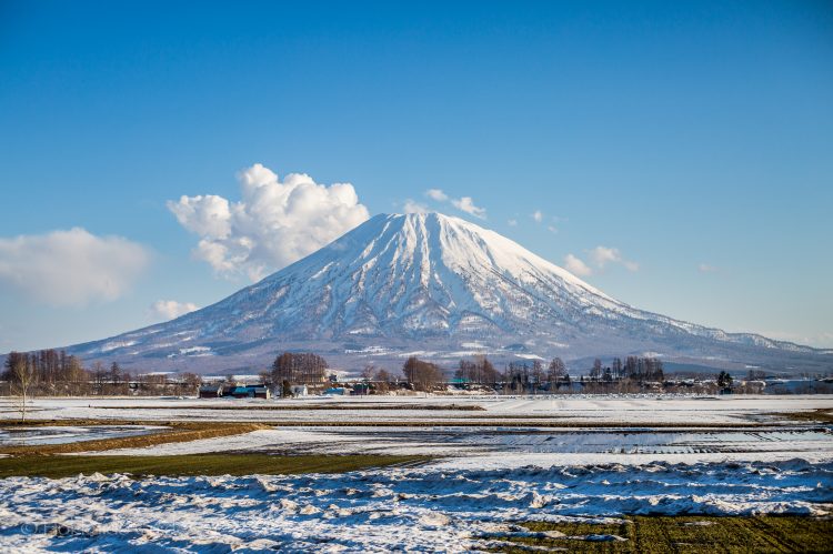

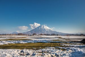 Mount Yotei is an active stratovolcano that can be found in the Shikotsu-Toya National Park. It is also known as ‘Ezo Fuji’ (Ezo being the old name for Hokkaido). It is in the top hundred mountains of Japan, and is definitely a breathtaking mountain to look at. This iconic mountain can be seen from all the surrounding farmlands and the ski slopes of the big towns of Hirafu, Niseko, Rusutsu and Kutchan. Not only is its snow covered peak popular in Winter, but the Summer, Spring, and Autumn brings hikers and trekkers to its base as there is a great hiking trail on the western side. From this peak, you will be amazed at the beautiful views from its peak. For those who do decide to trek to the top it takes about seven to ten hours for a round trip. There is a campground near the base as well.