Yuni Togakushi Shrine
Posted on
Yuni Togakushi Shrine is a small rural Shinto shrine located in the Furusan district of Yuni, Hokkaido. Although little is known about its exact origins, it is believed to have been established during Hokkaido's settlement period Read More ....


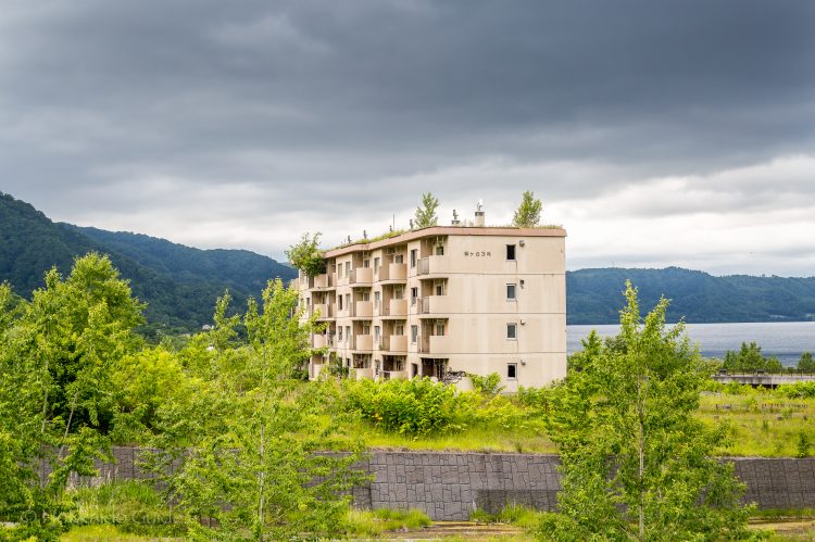

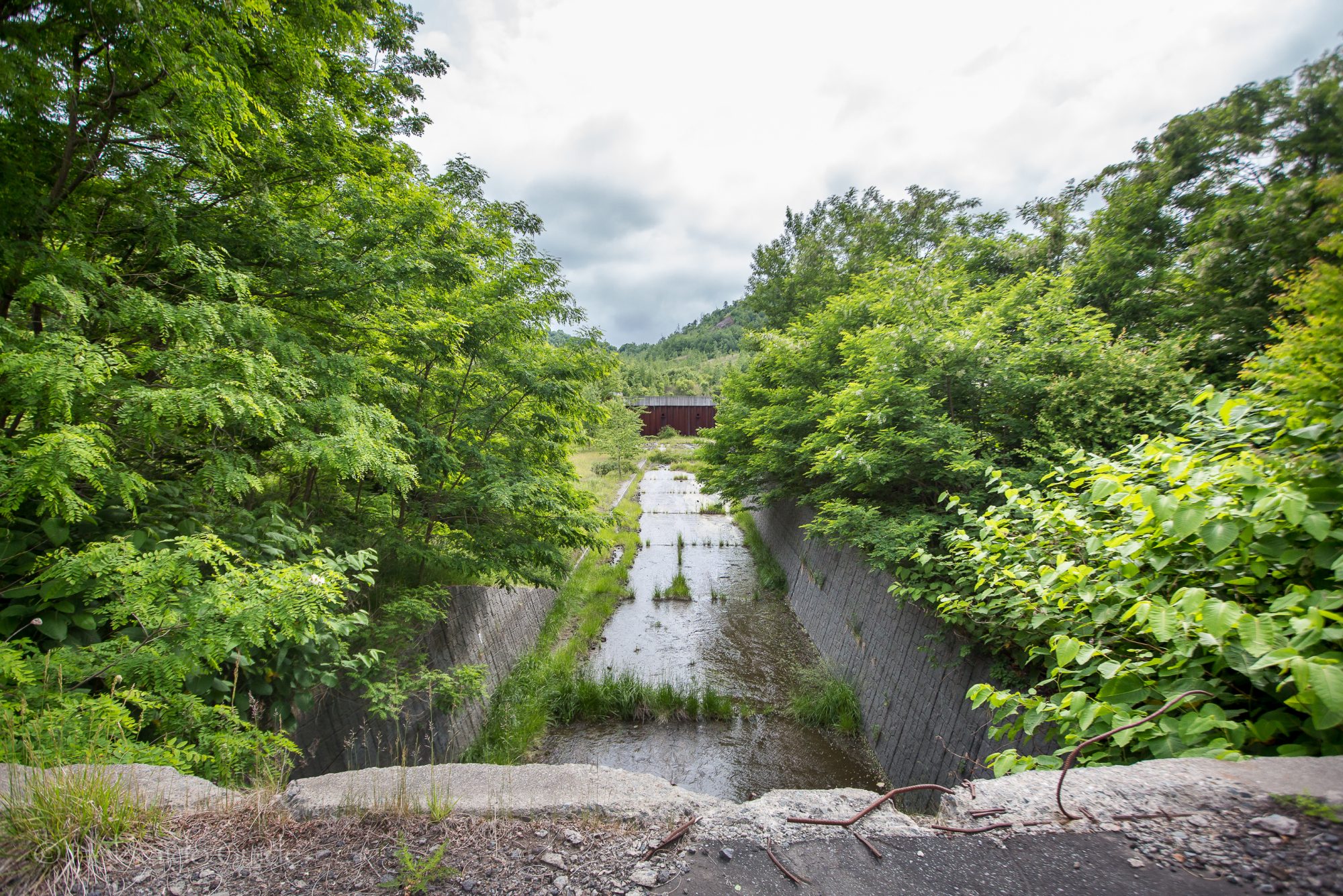
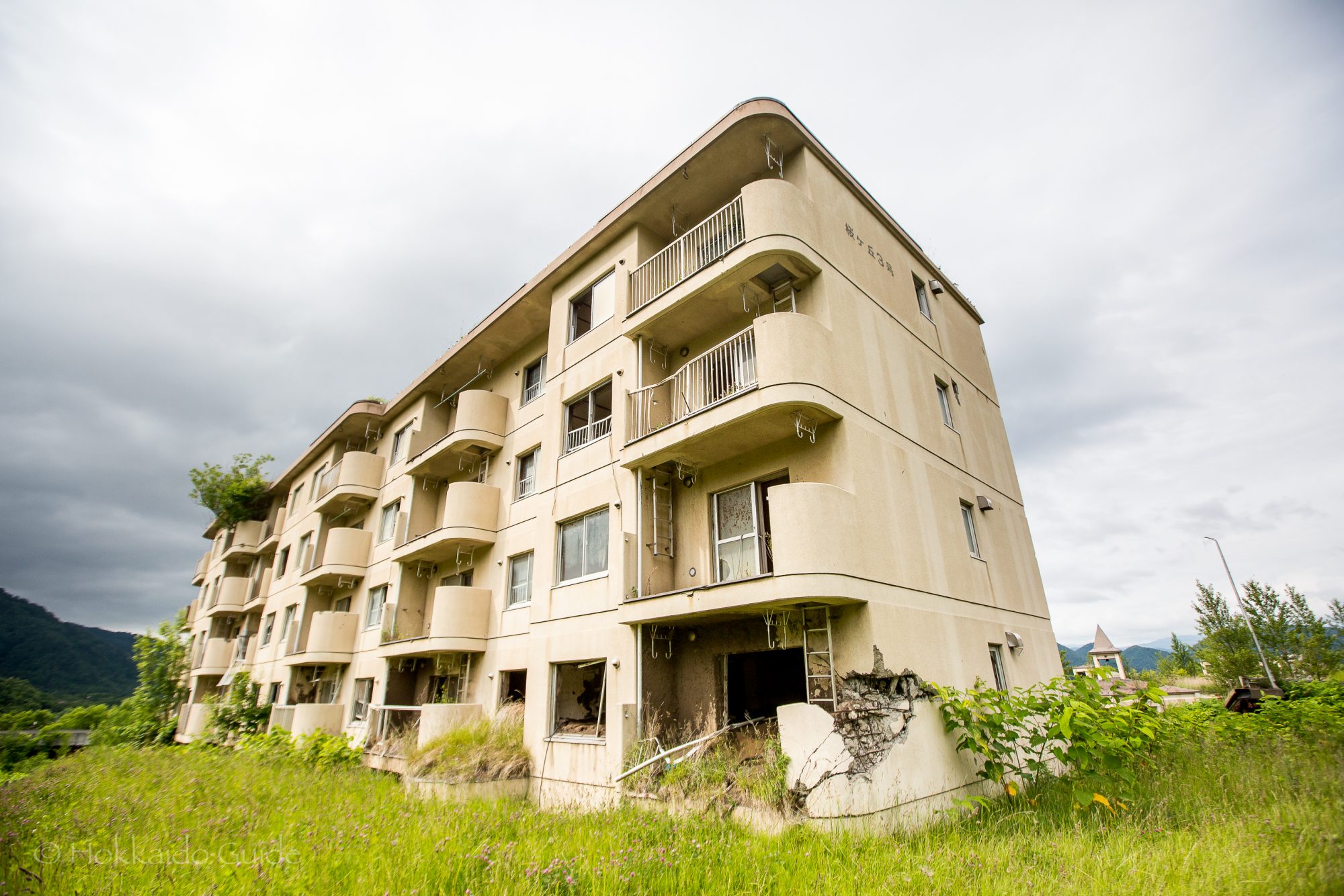
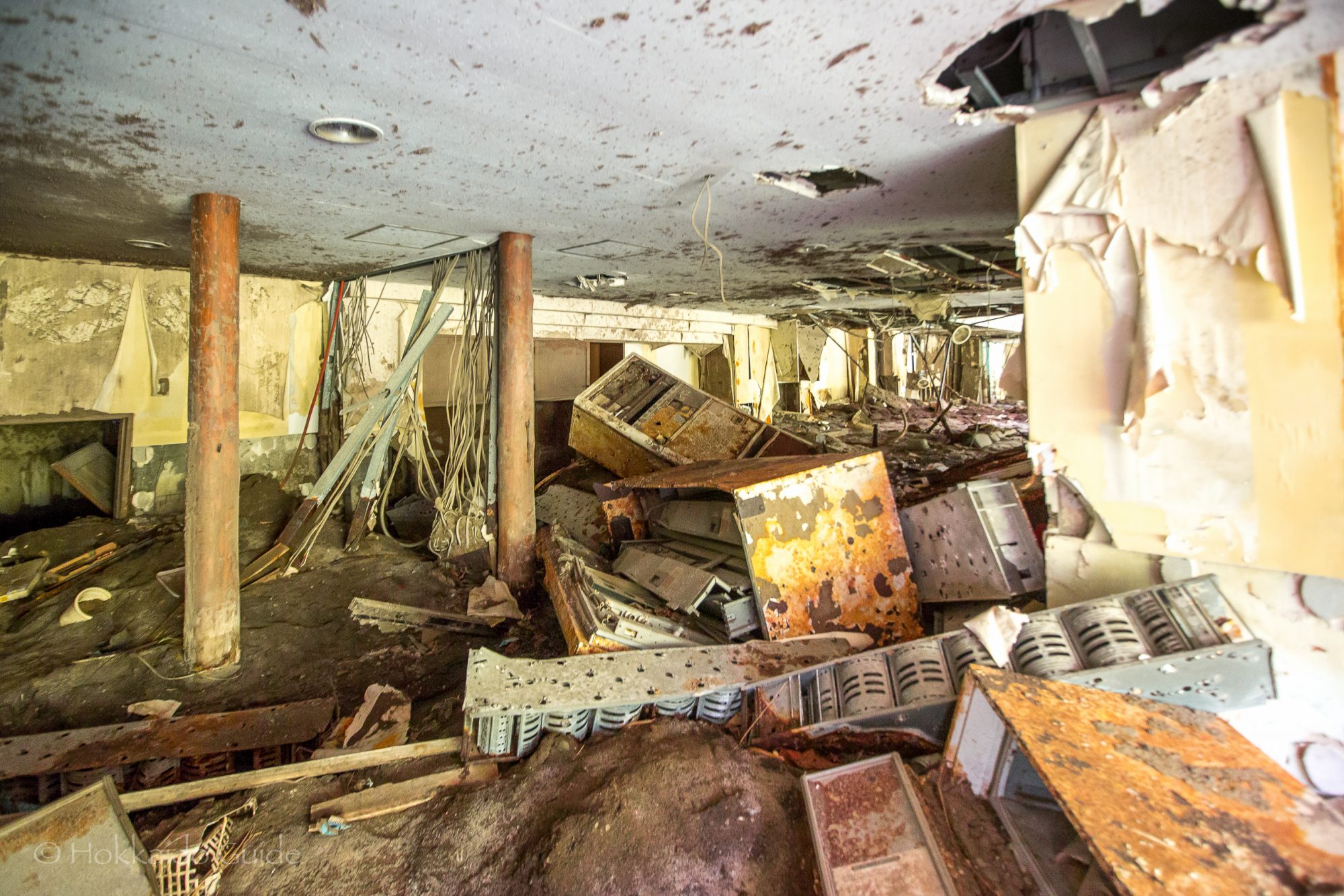
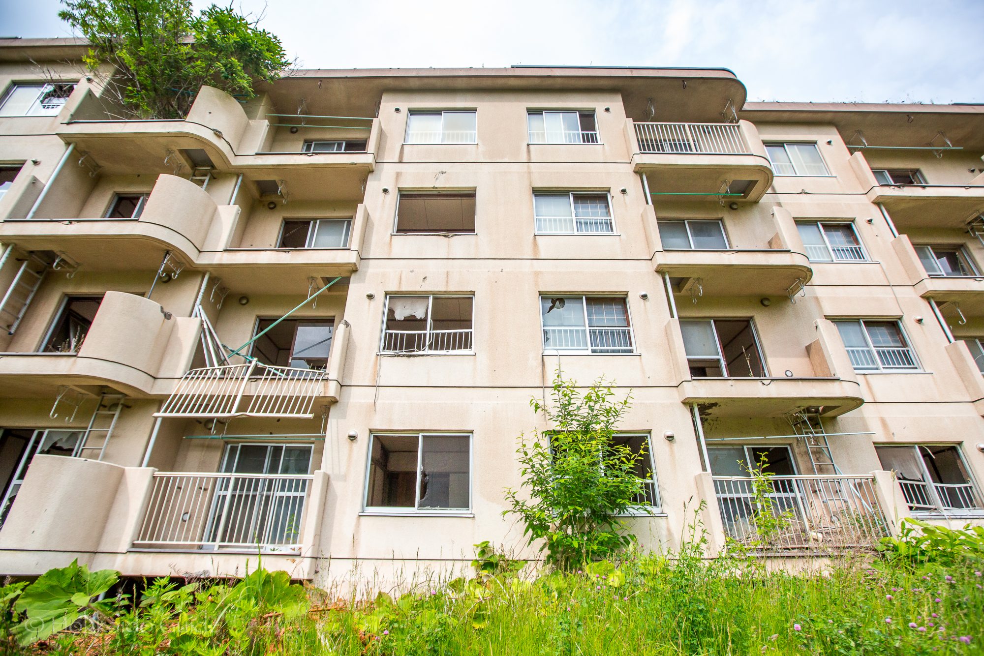
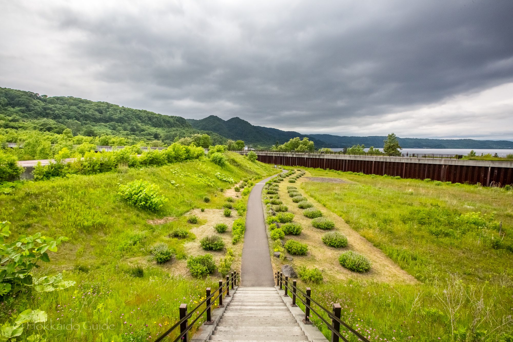
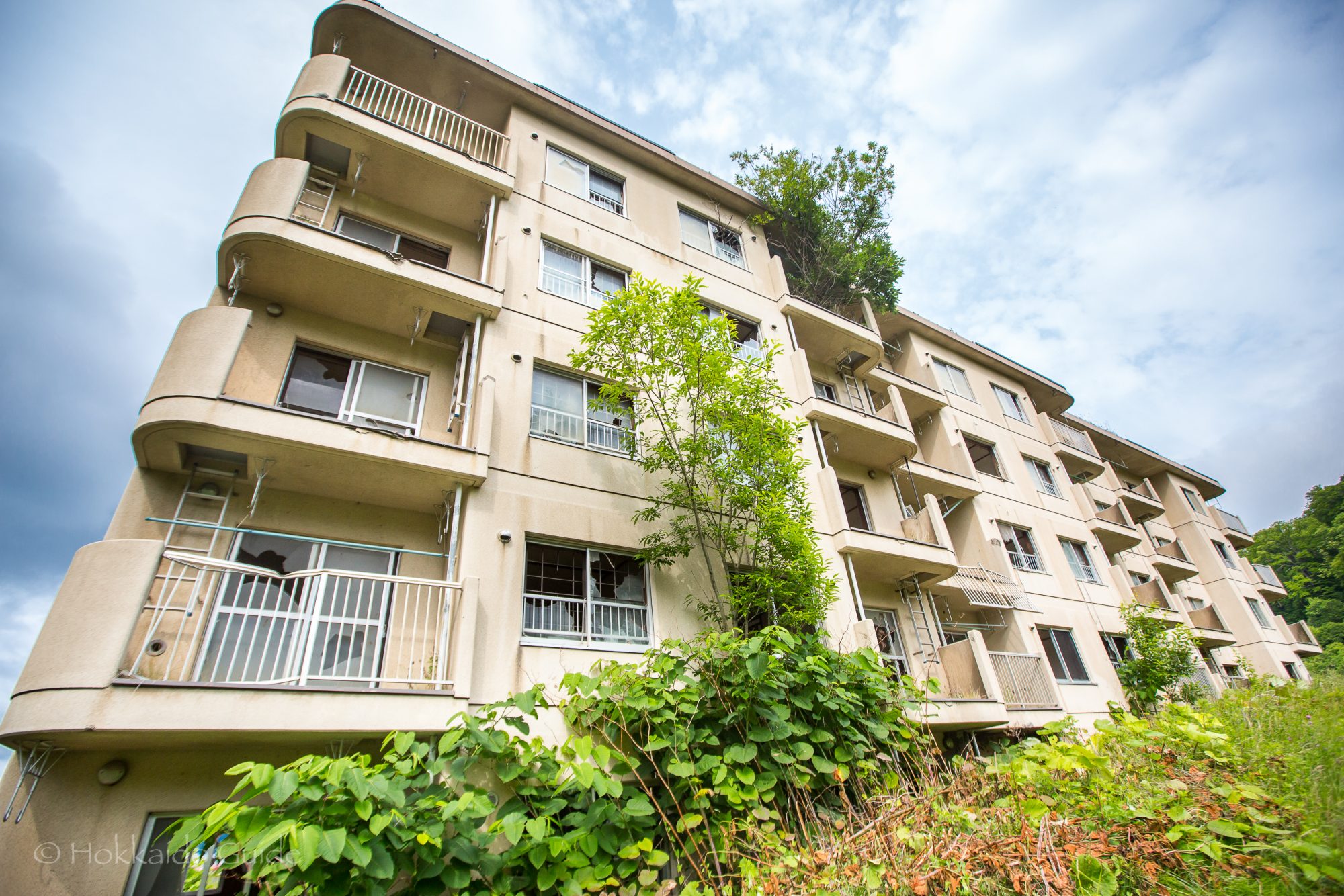
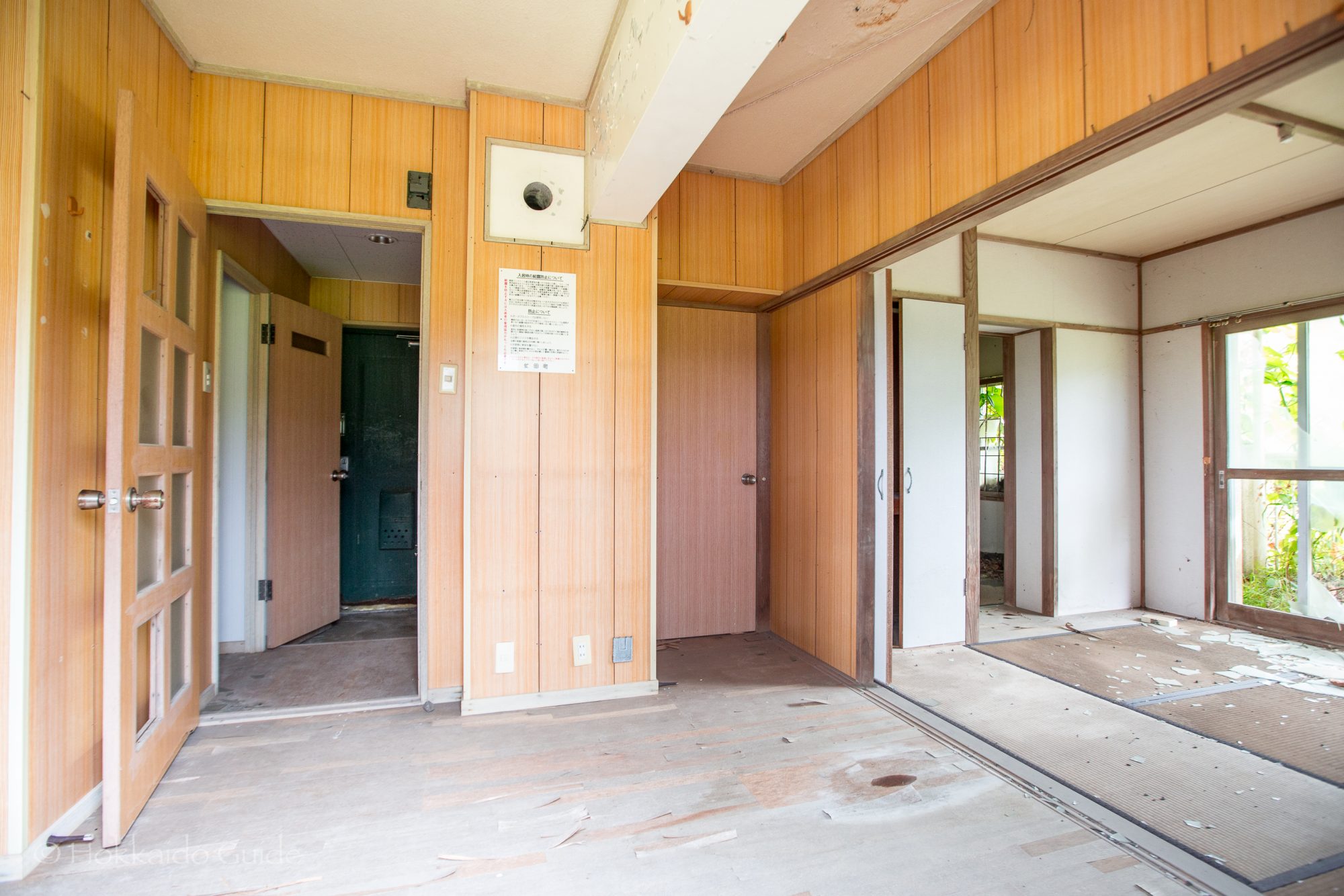
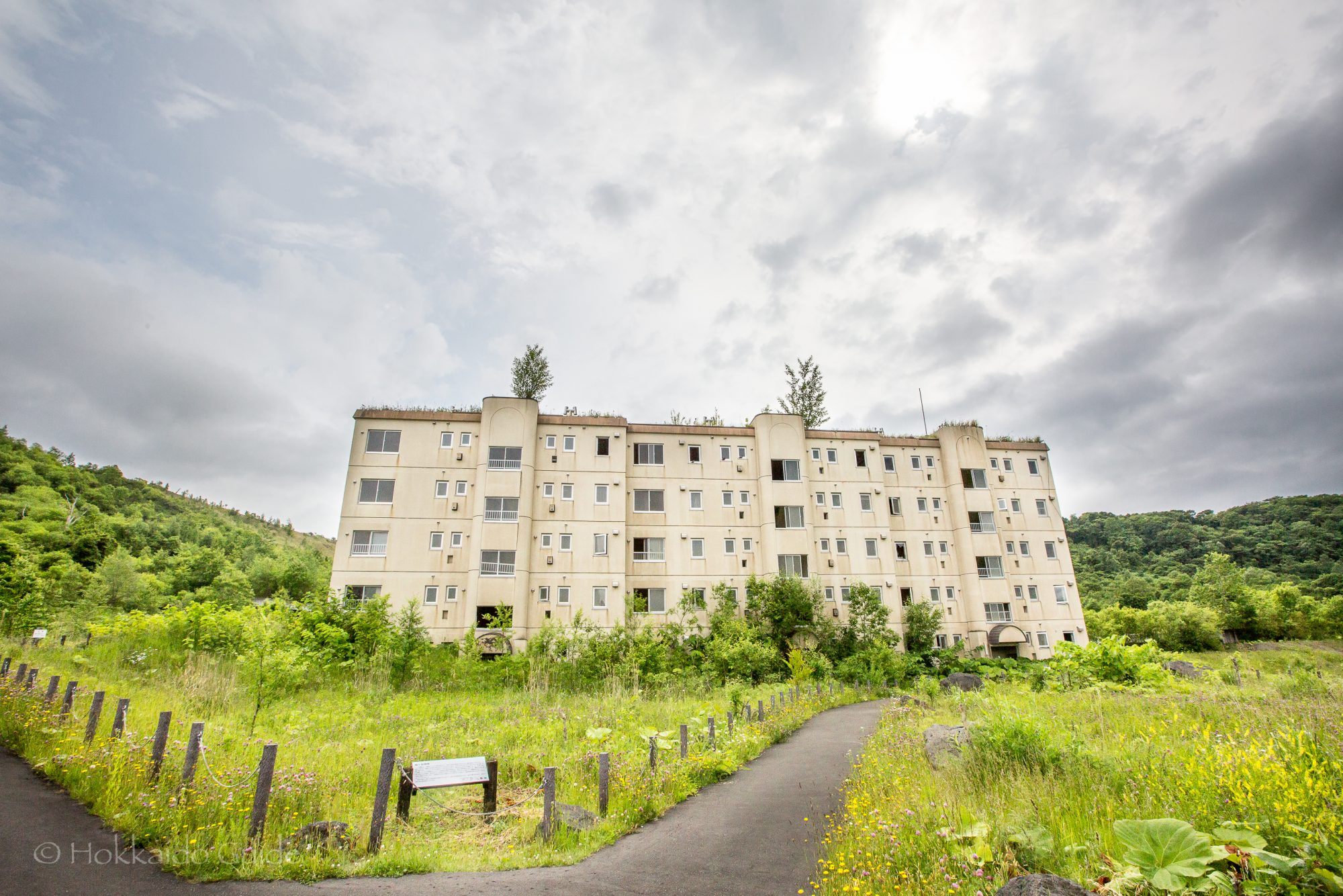
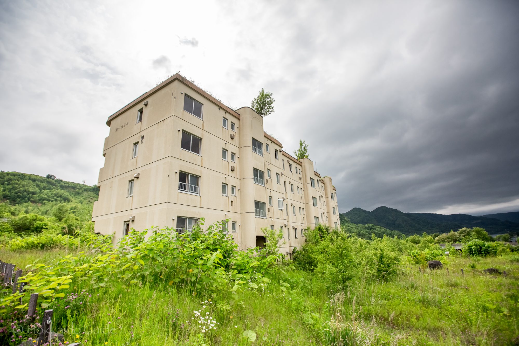
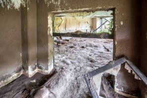 On March 27, 2000 Lake Toya was hit by volcanic activity and a number of large earthquakes causing some fault lines and the evacuation of the local residents. 4 days later,
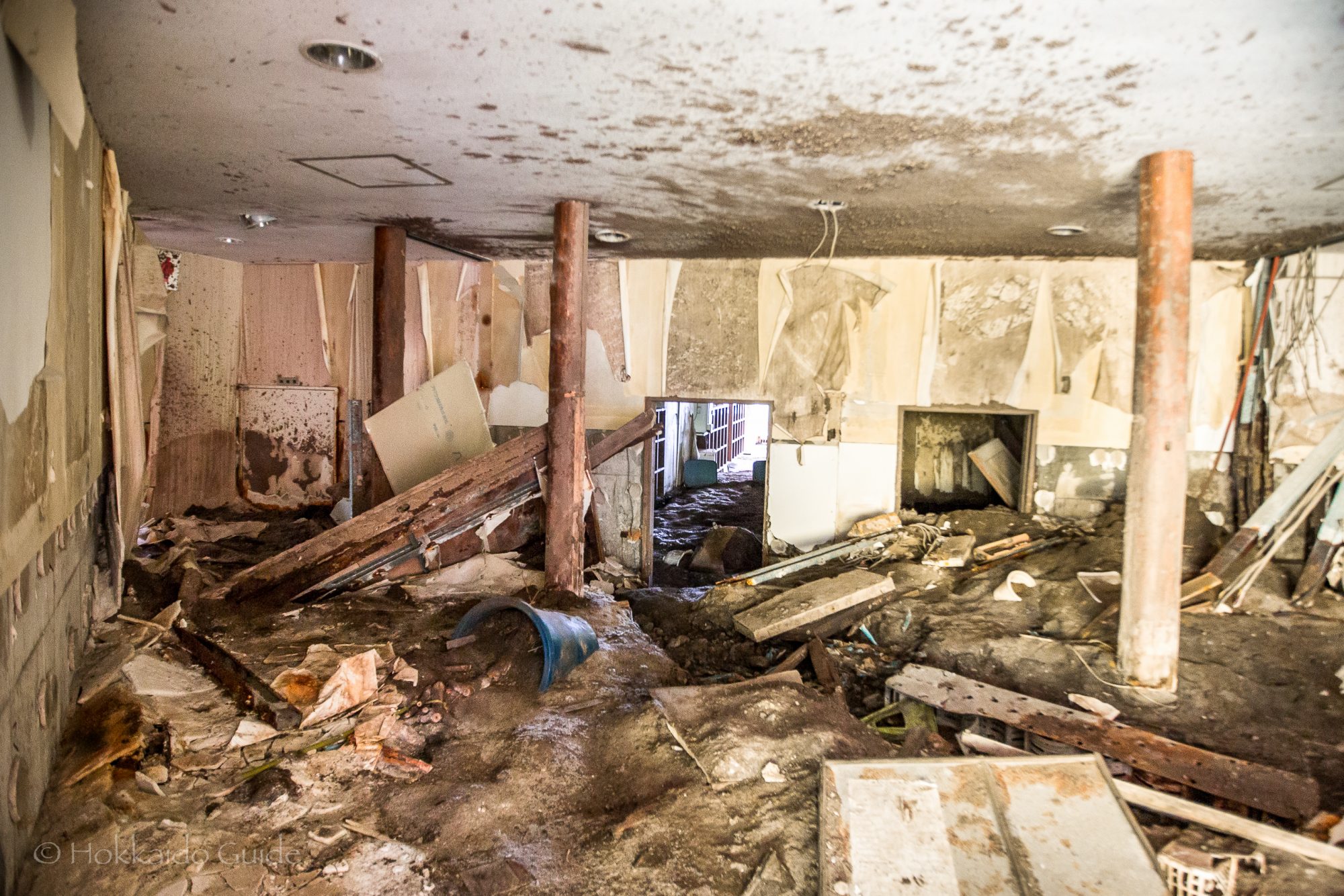
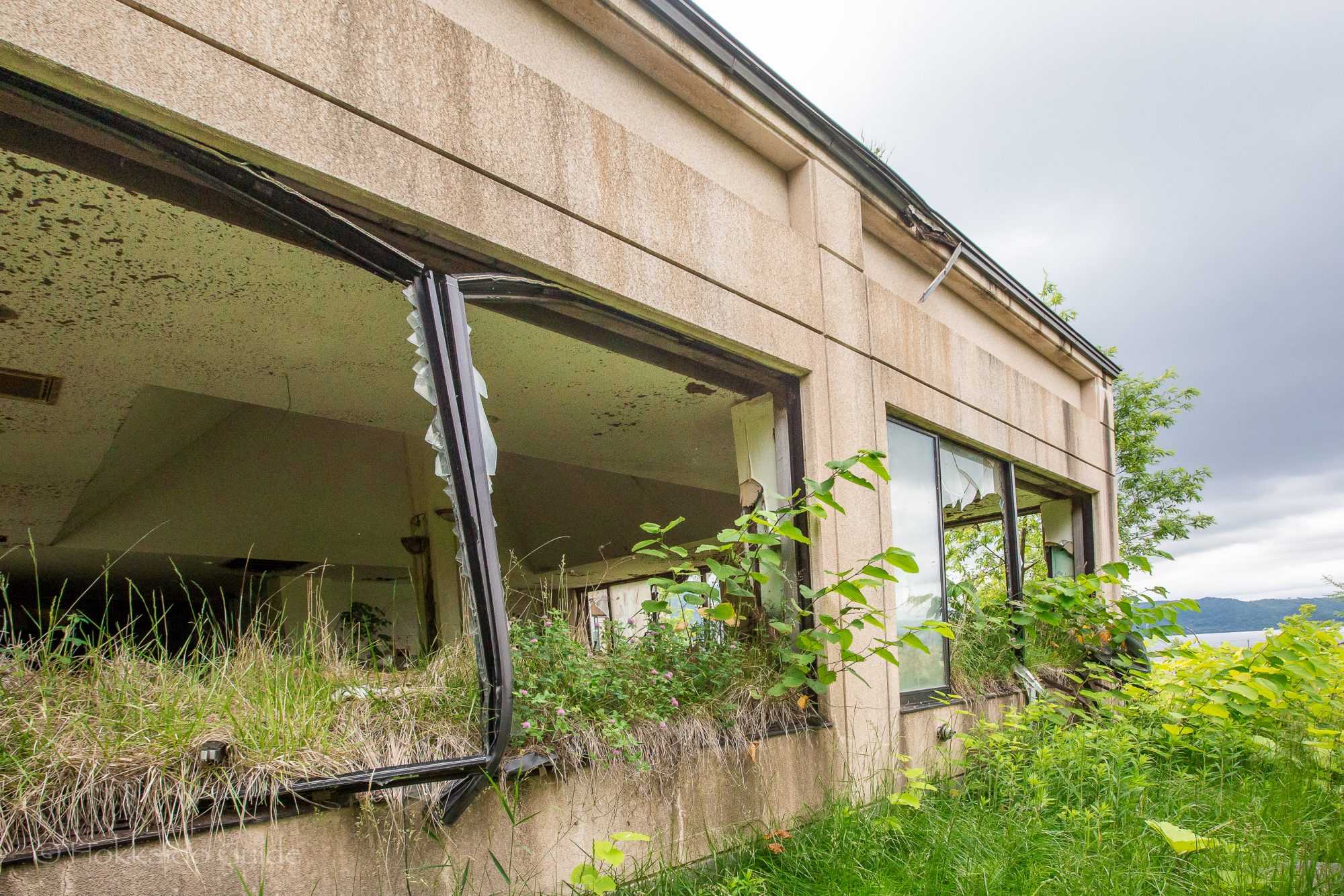
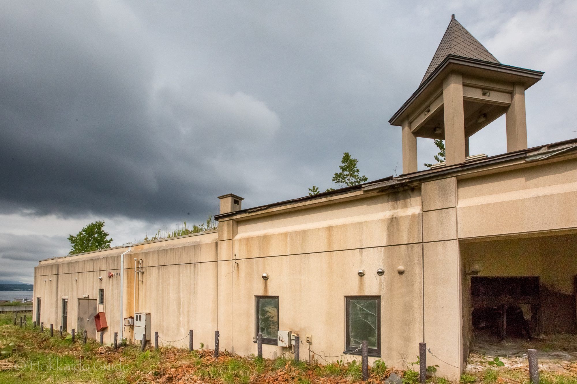
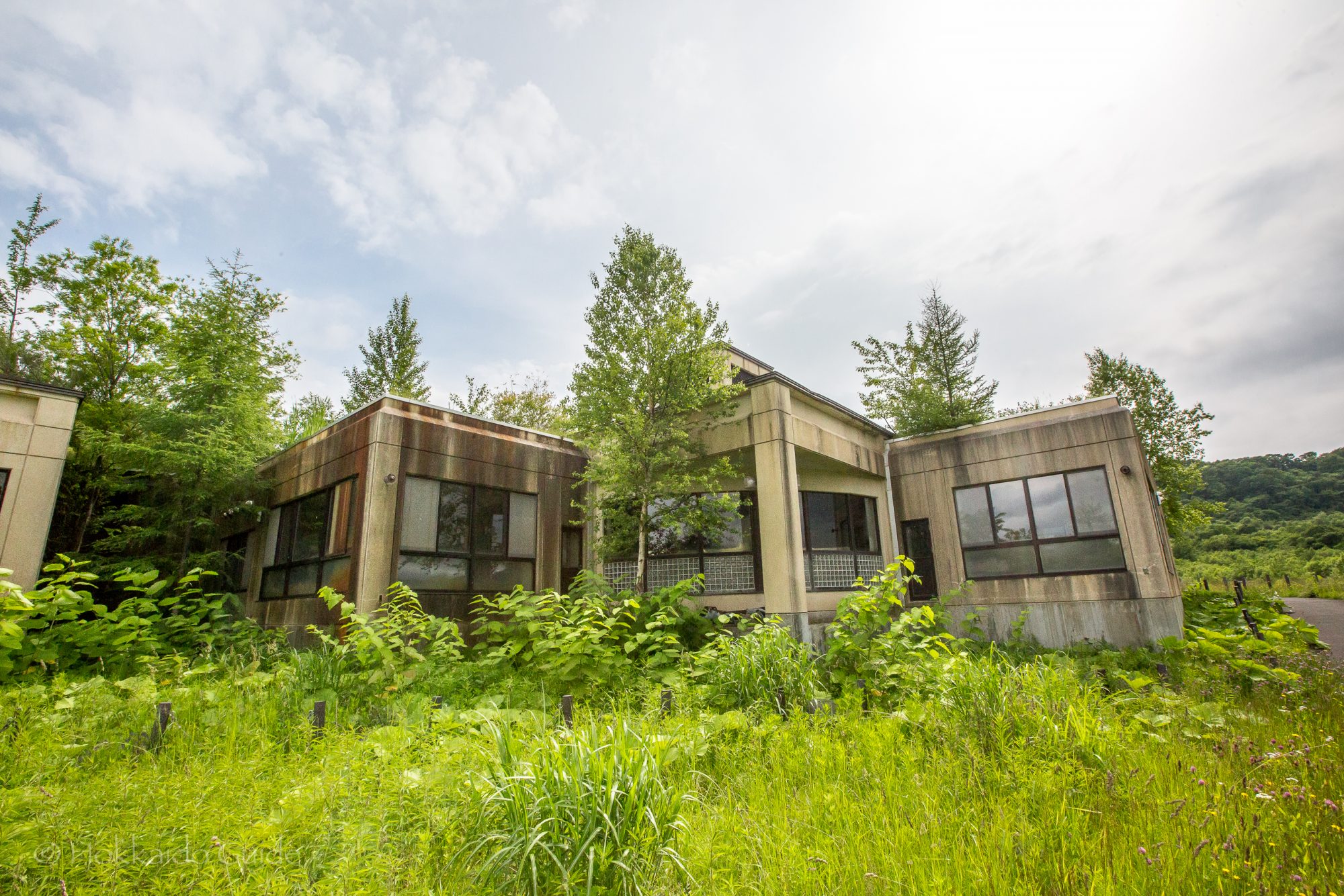
 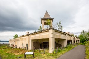 The outcome included the destruction of 234 homes and damage to a further 217. Fortunately, due to the evacuations there were no casualties. These buildings are fascinating to walk around and to peer into past events. In the quiet of the countryside, they serve as a spooky reminder to the power of mother nature. The path to the building ruins is easy to follow and it is recommended to follow it further up to the